Wales-ish OpenTripPlanner Graph
This is an OpenTripPlanner network graph for planning trips, by car or public transport, between places in Wales - including where these trips involve a short journey entirely within England. (It likely also works well enough for planning trips between places in Wales and a small number of English towns just the other side of the border.)
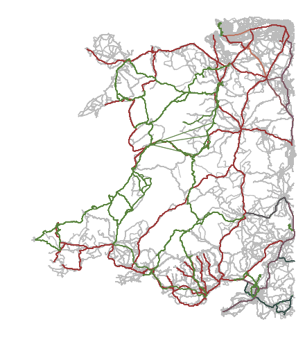
The map shows bus and train routes included in the latest graph, giving a rough idea of the region included.
How to use this
The graph file was last updated at 08:21 GMT on 30 December 2024. (The graph should update weekly.)
Download the latest release of the Wales-ish OTP graph here. You’ll need to download the otp_and_graph.zip asset.
You can then start OpenTripPlanner using run-otp.bat (under
Windows) or run-otp.sh (under Linux or macOS). Eventually it’ll
print “Started listener bound to [0.0.0.0:8080]” and you’ll be able to
access the planner at http://localhost:8080 .
(You’ll need install Java 21. See the OTP documentation for more information.)
You can see the code used to download source data and generate this graph here.
License
The graph.obj graph file is made available under the ODbL v1.0 by Adam Watkins as part of the Wales-ish OTP graph project.
The graph file contains:
- street map information obtained from OpenStreetMap contributors, via Geofabrik.de, under the ODbL v1.0,
- heavy rail timetable information obtained from RSP Limited (Rail Delivery Group) under the CC-BY v2.0, and
- bus and other public transport services timetable information obtained from Traveline and the UK Department for Transport under the OGL v3.0.
- Terrain 50 topology data obtained from Ordnance Survey under the OGL v3.0 (Contains OS data © Crown copyright and database right 2022).
The graph file is provided without any warranty of any kind and without any endorsement by any of the individuals or organisations named above, for any purpose.
If you provide a routing service or similar using the graph file you should make sure that the above attributions are stated clearly. If you produce a set of routing instructions using such a routing service, these likely form a “derived database” and should also be provided under the ODbL v1.0, again with the attributions above attached.
otp.jar is a copy of the version of OpenTripPlanner used to generate the graph file; it is released under the LGPL v3.0 (or later). Again, it is provided without any warranty of any kind and without any endorsement, for any purpose.
Thanks
This project developed out of a NHS Welsh Modelling Collaborative hackathon, with the support of colleagues across NHS Wales including James Cooke of the Welsh Ambulance Service.
It depends entirely on the work done by OpenStreetMap contributors, Malcolm Morgan (University of Leeds, Institute for Transport Studies) and UK2GTFS contributors, Traveline, the osmium developers, and of course the OpenTripPlanner developers.
Important inspiration included the graphite project produced as part of a piece of work by the ONS Data Campus. Also of note is the OTP4GB project and other work by ODI Leeds.